


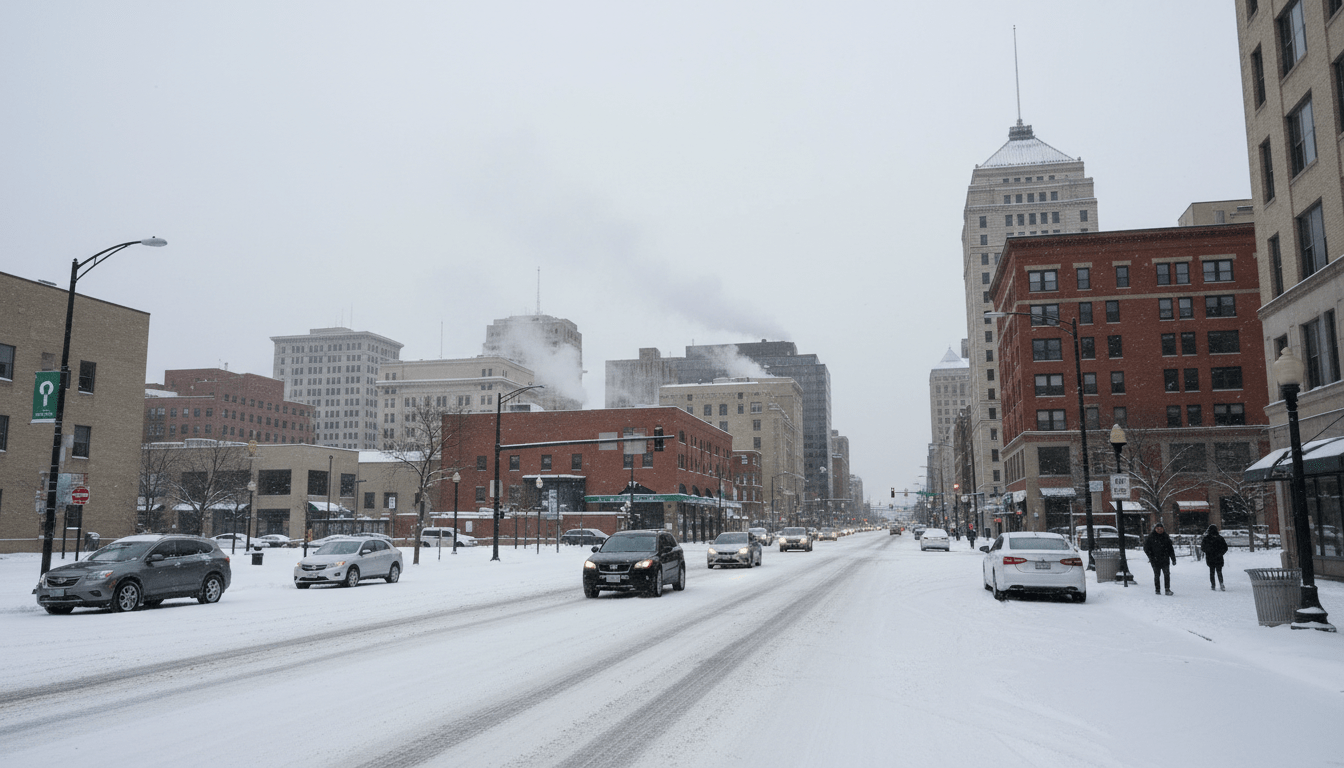
As the holiday season concludes, residents across Southeast Michigan are bracing for a significant shift in weather patterns. The Detroit snow forecast for January indicates a transition away from the milder temperatures seen in early winter, moving toward a more traditional, volatile mix of arctic air and lake effect precipitation. Meteorologists and city officials are urging locals to prepare for potentially hazardous driving conditions and dropping temperatures in the coming weeks.
According to data from the National Weather Service (NWS) Detroit/Pontiac office, January is historically one of the coldest and snowiest months for the region. While early winter offered some reprieve, atmospheric models suggest that the jet stream is dipping south, opening a corridor for colder air masses to descend from Canada. This shift is expected to activate the Great Lakes snow machine, bringing periodic accumulation to the metro area.
The January Outlook and Atmospheric Trends
The current meteorological setup suggests a persistent trough over the eastern United States. For Detroit, this translates to sustained temperatures hovering near or below freezing during the day, with overnight lows dipping into the single digits or teens. This temperature drop is a crucial component of the current Detroit snow forecast, as it allows snow to stick to pavement rather than melting on contact.
Forecasters are closely monitoring wind patterns coming off Lake Michigan. When westerly or northwesterly winds align, moisture is picked up from the unfrozen lake surface and deposited across the state. While the heaviest accumulation usually occurs in Western Michigan, strong systems often maintain enough energy to drop several inches of snow on Wayne, Oakland, and Macomb counties.
“The temperature differential between the relatively warm lake waters and the arctic air mass is the primary driver for these systems,” stated reports from local meteorological outlets. “Even without a major synoptic storm system, this lake effect setup can lead to sudden squalls and reduced visibility for Detroit commuters.”
Impact of the Detroit Snow Forecast on Commuters
The return of winter weather inevitably impacts local transportation. The Detroit Department of Public Works (DPW) has indicated that crews are on standby to address deteriorating road conditions. The city utilizes a tiered system for snow removal, prioritizing major thoroughfares and emergency routes before addressing residential side streets.
For daily commuters, the shifting Detroit snow forecast serves as a reminder to adjust travel habits. Local law enforcement agencies typically see a spike in traffic accidents during the first major localized snow events of the year. Authorities recommend the following for January travel:
- Increase following distance: Drivers should leave at least three to four car lengths between vehicles.
- Check tire pressure: Cold air compresses air molecules, leading to under-inflated tires which reduce traction.
- Carry an emergency kit: Including blankets, jumper cables, and a shovel is standard advice for Michigan winters.
City Preparations and Snow Emergency Protocols
When accumulation exceeds certain thresholds, the City of Detroit may declare a Snow Emergency. This protocol requires residents to remove vehicles from street parking to allow plows to clear curb-to-curb. Failure to comply can result in ticketing and towing, a measure city officials emphasize is necessary for effective clearing.
“Our goal is to ensure that police, fire, and EMS can reach residents in every neighborhood,” city officials have noted in previous seasonal briefings. “Cooperation from residents regarding parking restrictions is vital for the efficiency of our plow teams.”
Residents are encouraged to monitor local neighborhood updates to know when specific snow emergency ordinances go into effect. The city generally provides updates via official social media channels and local news alerts.
Historical Context: Is This Normal?
While the prospect of snow and ice can be daunting, climatological data places this forecast well within normal ranges. Data from the National Oceanic and Atmospheric Administration (NOAA) indicates that Detroit averages roughly 12 to 14 inches of snow during January. However, totals can vary wildly depending on the path of specific storms.
In recent years, Detroit has experienced milder winters due to El Niño patterns, making a return to average snowfall feel more severe to residents accustomed to lighter precipitation. This year’s Detroit snow forecast aligns more closely with historical averages, signaling a return to a “classic” Michigan winter rather than an outlier event.
Home Safety and Infrastructure Concerns
Beyond the roads, the drop in mercury poses risks to local infrastructure. Homeowners are advised to disconnect garden hoses and insulate pipes in unheated areas like garages or basements to prevent bursting. The combination of wind chill and ambient cold can freeze plumbing rapidly if precautions are not taken.
Furthermore, heating costs are projected to rise as furnaces work overtime to combat the freeze. Local utility providers recommend changing furnace filters regularly to maintain efficiency and sealing drafty windows to retain heat. For residents requiring assistance, local organizations and the National Weather Service often provide resources and alerts regarding warming centers during extreme cold snaps.
What Lies Ahead
Looking toward the end of the month, long-range models show a potential for continued activity. The active storm track suggests that Detroit will likely see actionable snow events every few days rather than one massive blizzard, though a large system cannot be ruled out. Residents should remain vigilant, keep their devices charged, and stay updated on the evolving Detroit snow forecast as the month progresses.