


DETROIT — City officials and urban planners unveiled a comprehensive proposal Tuesday for a new Eastside greenway expansion designed to bridge the gap between inland neighborhoods and the celebrated Detroit Riverfront.
The $18 million project aims to transform underutilized alleyways and vacant corridors into a contiguous three-mile recreational path, connecting the Jefferson Chalmers neighborhood directly to the Riverwalk. The initiative is being touted as a critical step in providing equitable access to public spaces for residents who have historically been cut off from the shoreline by industrial zones.
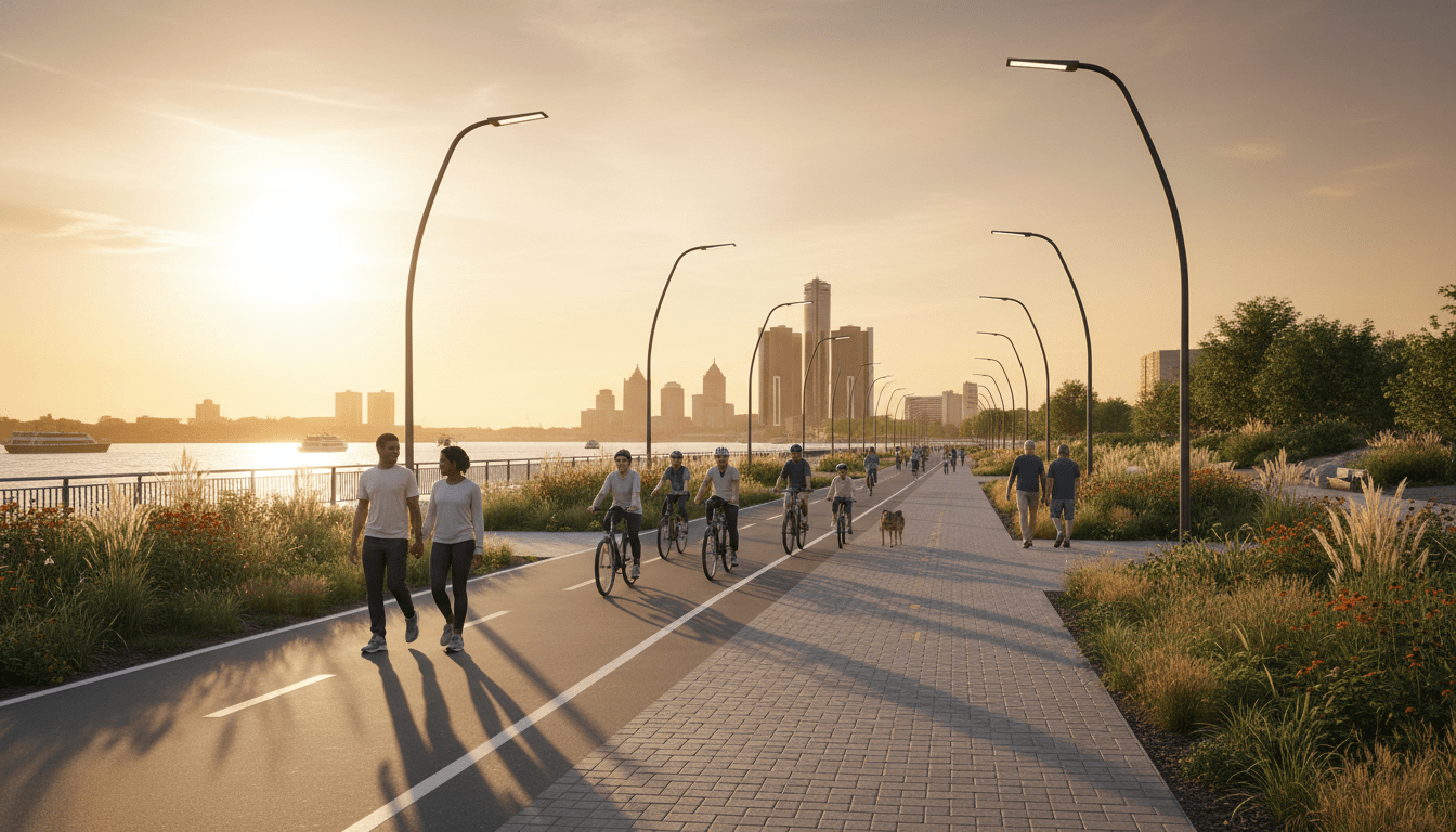
Details of the Detroit Eastside Greenway Expansion
According to the Detroit Planning and Development Department, the new route will prioritize safety and accessibility. The path will feature separate lanes for cyclists and pedestrians, enhanced LED lighting for night use, and native landscaping to manage stormwater runoff.
“This is not just about pouring concrete; it is about knitting the city back together,” said Interim Director of Planning, Marcus Turner. “The Eastside greenway expansion ensures that residents in Jefferson Chalmers and the Marina District have the same seamless access to our world-class riverfront as those living downtown.”
The design philosophy mirrors the success of recent projects covered by DetroitCityNews.com, specifically the ongoing progress on the Joe Louis Greenway. Planners envision a network where these smaller connectors eventually feed into the larger 27.5-mile loop, creating a fully walkable city.
Impact on Local Residents and Economy
Economic development experts suggest the project could spur revitalization in adjacent residential areas. Data from the Southeast Michigan Council of Governments (SEMCOG) indicates that properties located within a quarter-mile of protected greenways see a stabilization in value and an increase in local foot traffic for small businesses.
However, city officials are mindful of gentrification concerns. The proposal includes provisions for the preservation of affordable housing along the route to ensure long-term residents can enjoy the new amenities without facing displacement pressures.
“We want to see the neighborhood grow, but we want it to grow for the people who stayed,” Turner added during the press briefing.
Timeline and Funding Sources
Funding for the project is a blend of federal transportation grants, allocation from the American Rescue Plan Act (ARPA), and private philanthropic donations managed in partnership with the Detroit Riverfront Conservancy. Groundbreaking is tentatively scheduled for Spring 2025, with a projected completion date of late 2026.
Community engagement meetings are scheduled throughout next month at the East Lake Community Center, where residents can review the proposed maps and offer feedback on specific amenities, such as hydration stations and bike repair kiosks.