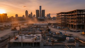


The long-awaited transformation of the I-375 freeway into a street-level boulevard is entering a critical planning phase, marking one of the most significant infrastructure changes in the city’s recent history. As the I-375 Detroit project moves forward, city planners and state officials are working to address logistics, traffic flow, and the historical implications of the site.
The project, funded largely by federal grants aimed at reconnecting communities divided by mid-century highway construction, seeks to replace the sunken one-mile stretch of interstate with a slower, pedestrian-friendly boulevard. According to the Michigan Department of Transportation (MDOT), the construction timeline is slated to begin in 2025, pending final design approvals.
Impact on Residents and Commuters
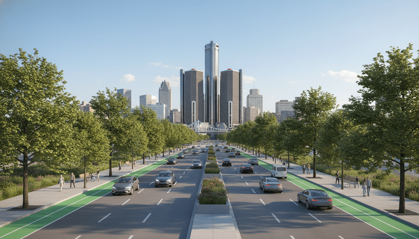
For residents living in Lafayette Park and visitors heading to the Eastern Market, the transition will alter daily commute patterns significantly. The current freeway acts as a physical barrier between the central business district and residential neighborhoods to the east. The new design proposes at-grade intersections that aim to restore the street grid.
However, the transition period brings concerns regarding congestion. “While the end goal is connectivity, the construction phase will undoubtedly require patience from commuters,” stated a representative from the Detroit Department of Public Works during a recent community engagement meeting. Officials have promised robust detour plans to minimize disruption to downtown business operations.
Historical Background and Data
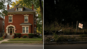
The I-375 Detroit corridor sits on the site of the historic Black Bottom neighborhood, a vibrant African American community that was razed in the 1950s to make way for the highway system. The current project is not just an engineering feat but is framed by federal officials as an act of restorative justice.
According to MDOT data, the current infrastructure bridges and retaining walls are nearing the end of their useful service life, making replacement necessary regardless of the design choice. By opting for a boulevard, the city reclaims approximately 30 acres of land. City planners are currently evaluating how this surplus land will be utilized, with discussions heavily focused on affordable housing and commercial space to support the growing neighborhood development updates tracked by city analysts.
What Happens Next?
Over the coming months, MDOT and the City of Detroit will finalize the design schematics. The focus remains on:
- Ensuring pedestrian safety across the new wide boulevard.
- Integrating dedicated bike lanes and green infrastructure.
- Finalizing the zoning for the reclaimed land parcels.
Residents can expect a series of public workshops throughout the year to provide feedback on the aesthetic and functional elements of the new boulevard. As the I-375 Detroit project evolves, it promises to reshape the physical and economic landscape of the downtown area for decades to come.